History
The history of Afourar
A market place on the seam between plain and mountain, remade in the middle of the twentieth century by one of Morocco’s biggest public works.
Before the town
Water first, then a town
There is no founding date for Afourar, because for most of its history it was not a town. The dir — the piedmont strip where the Atlas meets the Tadla — has supported small farming settlements for centuries, wherever springs and seasonal streams made irrigation possible without engineering.
Two worlds met here. On the plain were the Beni Amir and Beni Moussa, whose names the modern irrigation perimeters still carry. In the hills above were Tamazight-speaking communities, most immediately the Aït Attab, whose territory begins about twenty kilometres south-east. The weekly market was where the two economies exchanged — grain and manufactured goods up, livestock, wool, walnuts and honey down.
The name itself is Amazigh. Its two common spellings, Afourar and Afourer, are transcription variants rather than different names; Arabic writes it أفورار.
The hydraulic era
How the 1940s made the modern town
Afourar’s shape today was set by a single project: the decision to dam the El Abid and irrigate the Tadla.
Under the French protectorate, the Tadla was one of Morocco’s priority agricultural regions, and from the 1930s onwards the administration pursued a large-scale irrigation scheme for the Beni Amir and Beni Moussa lands. The scheme needed stored water, and the obvious place to store it was the El Abid gorge at Bin El Ouidane.
Construction of the 133-metre arch dam ran from 1949 to 1953. A project of that size, in mountains with no existing infrastructure, needed a forward base on the plain: accommodation, workshops, offices, a road. Afourar — at the foot of the climb, with water and flat land — was it.
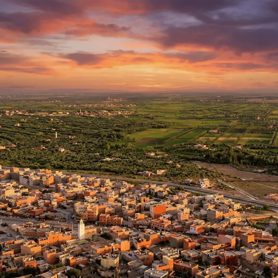
That is the origin of the quarter visitors often notice: low white villas with red-tiled roofs, set back from the road in mature gardens, laid out with the spacing of a planned settlement rather than an organic Moroccan town. It was built for the engineers and administrators attached to the works, and it gives part of Afourar an incongruous garden-suburb calm.
When the dam closed in 1953, the water it released changed the plain permanently — and left Afourar with a power station, a canal, a road to the mountains and a population that had arrived to build all three.
Timeline
Eight dates that made Afourar
- 1949–1953
The Bin El Ouidane dam is built
A 133-metre arch dam closes the El Abid gorge 32 km up the mountain, creating a reservoir of roughly 1.5 billion cubic metres and a hydroelectric plant of about 135 MW.
- 1950s
The Tadla is irrigated
Canals carry stored water across the plain to the Beni Amir and Beni Moussa perimeters — about 69,500 hectares. Citrus, sugar beet and fodder crops replace dry-farmed cereal on a large scale.
- 1964
Murcott mandarins are planted at the INRA station
Morocco’s agricultural research institute maintains an experimental domain at Afourer, part of the Tadla regional centre. Citrus collections are established there through the 1960s.
- 1977–1982
A chance seedling is found
Dr El-Bachir Nadori, working on citrus selection, makes crosses using Murcott in 1977 and in 1982 identifies a seedling with better colour, flavour and peeling among the 18-year-old Murcott trees. It is recorded under the plot code INRA W.
- 1988–1990
Nadorcott becomes a commercial variety
Nadori establishes that the fruit sets almost no seed when trees are isolated from foreign citrus pollen. The first commercial orchards are planted in 1990.
- 2004
Morocco’s first pumped-storage station opens
The 465 MW Afourer STEP is commissioned above the town, using an 800-metre drop between two purpose-built reservoirs to store and release grid electricity.
- 2014
Census: 12,981 residents
Afourar records 12,981 inhabitants in the national census — broadly stable since 2004, in a province that has seen steady rural out-migration.
- Today
An origin, a stopover, a power plant
The Nadorcott is grown far from here; the station runs unattended by tourists; the souk still fills one morning a week. Afourar’s significance is mostly invisible from the road — which is the reason for this site.
Keep reading
Where the history leads
The dam gave Afourar a power station and the research station gave it a mandarin. Both stories are worth following.